Walking - be inspired to take the scenic route and see more of Rousay (and beyond!)
With its unique circular route around the whole island, Rousay is a thoroughly enjoyable walk, spanning 13 miles, with amazing scenery. It's a challenge with the steep roads known
as 'The Leeon' and the 'Sourin Brae', but it's definately worth it for getting the best views of Rousay and across to the rest of the Orkney Islands and beyond.
Many visitors cycle around the island, which could take up to 2 hours, although more time is needed if you wish to stop at any of the sites. If you do not plan to bring your own
bicycle, Trumland Organic Farm provides cycle hire from its base on Rousay.
Every year, on the last Saturday in August, the 'Rousay Lap' is held; a half-marathon in which many people - both local and visitors - run, walk, or cycle around the island.

But step off 'the beaten track', and you'll find numerous paths and hill-walks waiting for you. See below for some very special routes, but please remember that much of Rousay is farmed land, and, as such, respect for the farm animals, as well as the wildlife, is appreciated.
Blotchnie Fiold & Knitchen Hill
To get you started on the smaller routes, Rousay's highest hill (and the fifth-highest in the Orkney Islands) - Blotchnie Fiold - reaches a height of 250 metres.
The best way to reach the summit, is to take the longest of the two nature trails at Trumland Nature Reserve. Totalling 5km, this 3-hour route also takes in
Knitchen Hill (227 metres) and the Loch of Knitchen.
From the top, you are presented with breathtaking, elevated views of Rousay and indeed most of the Orkney Islands.
The view even extends to Fair Isle and the small Shetland island of Foula.
The shorter nature trail at the reserve is still an excellent route filled with plant life and birds and other wildlife, but at 1.5km, and taking approximately 1 hour, it is
restricted to the reserve's lower land.

Kierfea Hill
Kierfea Hill reaches a peak of 235 metres, and gives wonderful views of the district known as 'Sourin' (meaning 'Sour Land', as the land was said to be the less fertile part
of Rousay), as well as providing views across to nearby islands, including our neighbours on the island of Egilsay.
Westness Heritage Walk
For a truly unique walk, why not try the Westness Heritage Walk? A rough coastal path covering thousands of years of history in just one mile, it's been described as the most
important archaeological mile in Scotland, and gives views across to the mythical island of Eynhallow.
The Burn Path
To experience the views across to Eynhallow from a different perspective, and along a smaller route, take The Burn Path, which, as the name suggests, is a path following the
course of a burn. Going upwards along the hillside and waterfalls, this gives elevated views of Eynhallow and the Mainland of Orkney. A fantastic picnic spot on sunny days.
Knowe of Yarso
For more archaeological wonders, the half-a-mile walk up to the chambered cairn, Knowe of Yarso provides a heather-lined, uphill route, with elevated views of the district of
Frotoft on Rousay, and further afield to the Mainland of Orkney.
Knowe of Hunclett
The archaeology walks continue when you take a walk down to the coast to see the remains of Knowe of Hunclett.
Upper Avelshay Walk
And for something a bit different, try the circular, Upper Avelshay Walk (2km) across a marked, moorland path, and passing the folklore-inspired Cubbie Roo's Burden
(created by a giant in ancient times).
Faraclett Head Walk
Take to the coast with a walk along Faraclett Head Walk; an exciting 3.5km circular path. This marked path features caves amongst imposing, overhanging cliffs, with
spectacular views of the Westray Firth, and a wide variety of sea birds.
In strong northwesterly winds, take care as you watch the strong tides in the Rull Röst cause magificant, violent seas.

Sacquoy Head Walk
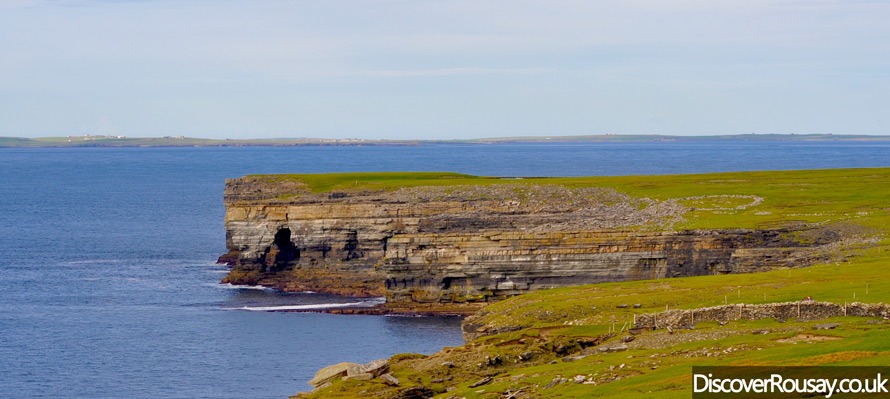
The Sacquoy Head Walk (6.4km return) is a fascinating coastal walk featuring high cliffs and magnificant sea birds.
Divert across to The Brings, where large cracks and natural arches in the rocks under the cliffs blow air when the winds are high, and continue past Rousay's highest cliff,
Hellia Spur, which stands at 65 metres.
Continue further still for panoramic, uninterrupted views of Quandale, which suffered from Highland-style clearances in the past.

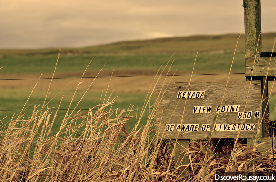
Kevada Viewpoint
Rousay is peppered with numerous nuggets of hidden delights for keen walkers, including secluded spots such as Kevada Viewpoint, which sits atop Innister Path, a shorter
trek below The Brings. Stretching to just 1.7km return, the walk takes you up the hillside, providing views over the district of Wester on Rousay, and across to Faraclett Head.
Scabra Head
A walk out to Scabra Head will bring you to a magnificant natural arch - Hole of the Horses - with views across to the Eynhallow Sound and its turbulent waters
(with strong tides known as 'roosts' by Orcadians).
Old Peat Tracks - Muckle Water, Loomachun Walk, Kingarly Hill
Rousay's old peat tracks have left a distinct mark on the island's rich history, so why not step back in time with a trip up one of these rough tracks?
Rousay's largest loch, Muckle Water is situated at the end of one such track, in a peaceful setting.
Covering 3.5km (return), the walk also passes a smaller loch, Peerie Water.
Yet another peat track forms the route of the Loomachun Walk, taking you over rough, wild moorland, featuring heather-clad hills. But the views as you reach the top are
simply outstanding, with the remote, Loch of Loomachun the furthest point of this 4.7km (return) walk.
Whilst the peat tracks are a part of the island's vast history, they are also helping to shape Rousay's future; one track has been considerably improved, enabling access to Rousay's Community Wind Turbine, which will provide a funding source for community projects over the next 20 years. Following the track leads you right up to the turbine, which is set upon Kingarly Hill, with outstanding elevated views.

