History and Archaeology - be inspired to discover over 5,500 years of history
Rousay is home to over 160 archaeological sites, dating back to thousands of years ago. And they are all completely FREE to visit!
But with so many interesting historical and archaeological sites here, we've provided in-depth information about the most important sites for you to explore.
Westness Heritage Walk
The most impressive of the archaeological sites can be found along the most important archaeological mile in Scotland, which covers thousands of years of history in just one
mile-long rough coastal path, known as the Westness Heritage Walk. This amazing trail takes you on a journey through the first Stone Age settlers (from over 5,500 years ago),
to the Pictish Iron Age, the Viking invaders, the time of the Earls, and the crofting clearances of the early 1800s.

|
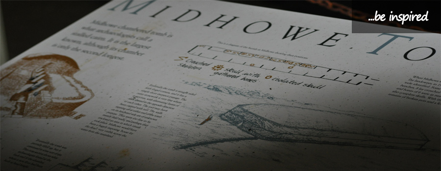
Midhowe Cairn
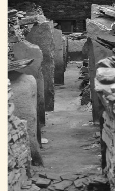
The walk includes the fascinating Midhowe Cairn, the longest and largest cairn in the Orkney Islands. Built around 3,500 B.C., it is housed in a large building in order to protect it from the natural elements. This is an excellent example of an 'Orkney-Cromarty'-type stalled cairn, with a central passageway that is flanked by pairs of stones separated into 12 compartments. Low stone benches were constructed between several of the stalls, with burials on top. The outer wall base was constructed using flat horizontal slabs of stone, with more slabs then laid at an angle in a 'herring-bone' style, with alternating layers, similar to the patterns found on Unstan Ware pottery. Known as the 'Great Ship of Death', excavation of the site - following its discovery in 1932 - uncovered the remains of 25 people, found in crouched positions either on or under the eastern shelves of the chamber. Two burials of a later date were also discoverd. Also found during excavation were the bones of birds (such as buzzard, eagle, gannet, skua), fish, oxen, pig, red deer, and sheep, indicating that the people were farmers and hunters, as well as confirming the existance of deer on Rousay in the past, as there is no longer any in the Orkney Islands today. A suspended walkway enables you to get a bird's-eye-view of this wonderful site. |
|
|

Midhowe Broch
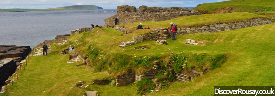
Next to the Cairn, sits the impressive Midhowe Broch, built as a fortified residence during the Iron Age, and occupied from around 200 B.C. to 200 A.D.
Overlooking Eynhallow Sound, it is thought that this may have been one of the earliest of the Orkney Islands' brochs to be a 'true' tower.
The broch has been incredibly well-preserved, with fireplaces, partitions, tanks, and a drystone alcove on one wall.
Evidence suggests the existance of a first-floor wooden gallery (possibly used as a bedroom), with a stairway leading to an upper gallery between the broch's walls.
Excavation of the site revealed many bone and stone tools, such as quern-stones and spindle whorls, suggesting that the people here spun wool.
Items of a Roman origin (e.g. a bronze ladle, pottery fragments) were also discovered. With Orkney not under Roman control, perhaps the inhabitants acquired these items through
trading, or on raiding excursions?
Bronze jewellery has also been found at the site of the Broch, suggesting wealthy inhabitants, while further evidence - including broken crucibles and moulds - points to a
bronze-worker being based at the site.
The remaining wall of this broch extends to 4.3 metres high.
A giant sea wall has been erected in order to protect this magnificant structure from the damaging effects of coastal erosion, ensuring that it remains one of the best-preserved
brochs in the Orkney Islands.
Brough Farm
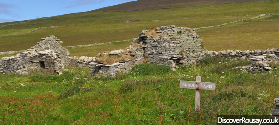
As you continue along the Westness Heritage Walk, you will pass the ruins of Brough Farm, which was once one of the most valuable estates in Orkney, dating back to the 1700s,
but it has been uninhabited since 1845.
The Wirk
The walk continues past The Wirk; a square tower adjoining a large, rectangular building, which is thought to have been a grand, two-storey ceremonial hall, dating
back to the 1200s.
St. Mary's Church
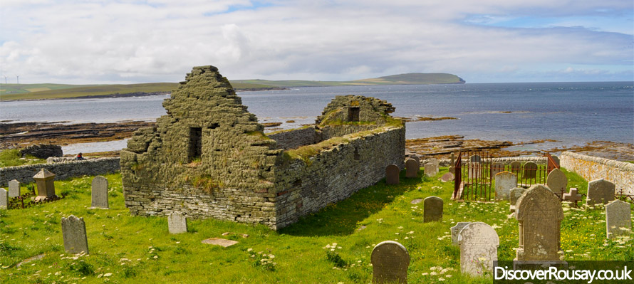
Along the Heritage Walk, see the ruins of St. Mary's Church; now roofless, it was built on the site of an earlier, medieval church.
It is thought that St. Mary's Church itself could date back to as far as the 1600s.
In the 1800s, large stone buttresses were added - a successful attempt to prevent the church from sliping down into the sea!
Some carved freestones, which may have originated from a tomb or chapel within the church, have been found at this site.
The church was abandoned in 1820, as the landowner ordered a clearance of the land.
Skaill Farm
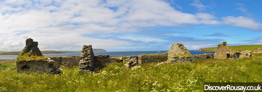
Continuing along, you will also pass the shells of buildings which were once part of the 18th-century farm of Skaill, but have remained derelict since the eviction of the
inhabitants in the early 1800s.

Knowe of Swandro
Following the Heritage Walk, you will take in the recently discovered site, Knowe of Swandro.
In recent years, Rousay has played host to a group of archaeology students from around the world as they gain valuable practical skills whilst doing actual excavation work.
Swandro is being given particular attention as coastal erosion threatens this important site.
The students, together with experienced archaeologists, carry out excavation work each summer, with the site carefully covered up over the winter months, in order to protect it from
the natural elements. Free Open Days and tours of the site are frequently held for anyone interested in seeing an excavation in progess.
Westness - Vikings & the famous Westness Brooch
The archaeological wonders continue onto Westness Farm, where, in 1963, a number of important finds were made. The first, in October of that year, was made accidentally,
when a hole was dug to bury a cow, but it unearthered some human bones, as well as two Norse oval brooches, a rectangular plaque of bronze, and a stunning Celtic brooch, which has
since been dubbed the 'Westness Brooch'. The brooch, which is made from silver-gilt and features gold filigree and inlaid amber, is thought to have been made in about 750AD,
and was still being used around 100 years later, during the Viking period.
The following month, the first Viking grave, containing the bodies of a young woman and her newborn baby was discovered. The burial also contained two oval brooches, a silver-gilt
ringed pin (eighth-century type), beads, a weaving batten, bronze straps, the remains of a bronze bowl, and a pair of wool combs.
The grave, which was found completely destroyed, is thought to have been built using horizontally-laid slabs.
All of the finds, including the Westness Brooch, are now on display in the National Museum of Scotland, Edinburgh.
Closeby sits a Norse boat shed and slipway, known as a 'noust' in Old Norse; a term for a natural or man-made place of shelter for boats.
The shed was about 8 metres long by 4.5 metres wide.
Nearby, two boat graves were excavated, each containing the remains of men, as well as weapons and tools. One man had four arrowheads in his body.
The boats were built using a technique used by Vikings, known as 'clinker building', with oak and iron nails. The shape of the boats could be made out from the iron rivets.
Westness Farm became the main farmstead in the area in around 1600, and is still being farmed today. The 'Traill' family, originally from Fife on Mainland Scotland, arrived
at Westness in 1615. The Traill family was to have a significant influence on shaping Rousay's future for hundreds of years to come.
The Traill family built Westness House in 1792, and it was originally the main mansion on Rousay; it is still privately-owned, and is not open to the public.
Quandale & the Highland-style Clearances
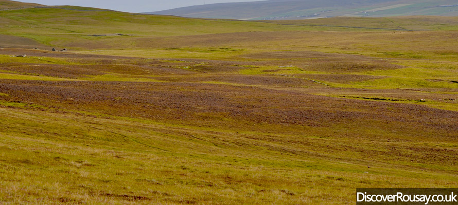
Rousay was the only place in the Orkney Islands to suffer from Highland-style clearances, ordered in the Westness and Quandale area in 1845 and 1855-59. Up until then,
Quandale had been known as one of the best corn (bere) growing areas in the North Isles of the Orkney Islands, but the landowner, George William Traill favoured sheep farming as he
strived to earn more money, resulting in the eviction of the people and the destroying of their farmsteads.
Now, the landscape provides some spectacular, widespread views of deserted Quandale, in its rugged beauty - you'll be transported back in time, as you spot the lonely remains of destroyed crofts,
forming a distinct, longlasting mark on the land, divided by turf dykes and traditional runrig systems.
House of Tafts
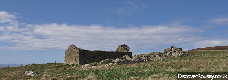
The House of Tafts is the only building that remains from the Quandale clearances. Now roofless and in disrepair, it is the oldest two-storey house in the Orkney Islands,
dating from at least the 16th century. Cleared in 1846, its corn kiln had only been built four years earlier, in 1842. A superior dwelling in its time, Tafts was akin to a miniature
mansion, with two stone windows and a chimney. The name, 'Tafts' is thought to come from Old Norse, 'Thopfts' (meaning 'dwelling').
Trumland House
Following the death of George William Traill in 1847, his nephew, General Sir Frederick William Traill-Burroughs inherited much of Rousay. Born in 1831, Traill-Burroughs was known
as the 'Little General' due to his short stature, and served as an officer in India, whilst in the British Army.
Traill-Burroughs appointed prestigious Edinburgh architect, David Bryce, to build a mansion for his wife, Eliza. The mansion - Trumland House - was completed in 1876, and
built in the traditional, Scottish Baronial style, costing a then-pricely sum of £12,000.
Sadly, Bryce died in the same year of its completion, with Trumland House one of the last houses that he designed.
The Little General contributed to the improvements of living standards on the island - for example, with the building of Trumland Pier (which is where the ferry to Rousay
now docks), the recruitment of the island's first resident doctor, the establishment of the island's first Post Office, and much more.
Following his death on 9 April 1905, the Little General's ghost was said to wander around Trumland House, and was reportedly seen by workmen one evening; the following night,
4 April 1985, the whole of the roof was destroyed by fire, with extensive damage to the upper floors. Although the house was re-roofed, it has not been lived in since the fire.
The present owners purchased the property in 2002, and soon launched an extensive restoration project to this Grade B-listed property, of which the first stage
('wind and water tight') has been achieved.
Trumland House isn't currently open to the public, although it is hoped that restoration will be complete within the next few years.
However, its spectacular and much-admired gardens are open to the public throughout the summer, and are accessed through a medieval gate, but please note that there is a small
admission charge of £2.00 (telephone 01856 821 322 to check prices and opening times).
Discover the official website of Trumland House: www.trumlandhouse.org

Digro
Traill-Burroughs' insistance on increasing rent to pay for his lavish spending on the building of Trumland House resulted in the eviction of many of his tennants, who could no
longer afford to stay on his land. For example:-
In 1883, James Leonard of Digro, Chairman of the Tenants' Committee gave evidence against the laird, General Burroughs to Lord Napier, as well as the Royal
Commission when they came to Rousay to discuss tenants' concerns. But, after hearing James express his and other tenants' views, General Burroughs evicted him and another local man,
James Grieve of Outerdykes, along with their families.
In 2001, an inscribed, polished stone, commemorating James Leonard's brave stance, was erected at the roadside at Digro.
It was unveiled during a small ceremony, by two of James' great-granddaughters.

Taversoe Tuick
Rousay is home to the unique, Taversoe Tuick; it's one of only two tombs in the Orkney Islands to feature two burial chambers set one above the other.
It was discovered in 1898, during the construction of a sheltered 'seat', which was being made for Traill-Burroughs and his wife to enjoy the views across to the islands of Wyre and
Gairsay, as well as to the Mainland of Orkney.
The tomb, which was used as a burial place for the area's farming community over 4,500 years ago, was then extensively excavated in 1937, during which several skeletons and
cremations, and a large amount of pottery was discovered.
It had first been thought that the upper chamber was an afterthought, but the excavation work revealed that it was, in fact, part of the original design.
The tomb's upper chamber is accessed via a grille door, while a ladder has been added to the inside, so as to provide access to the lower chamber.
Outside the main tomb at Taversoe Tuick, but very closeby, is a much smaller (miniature) chamber, which is divided by four upright slabs, and within which three Unstan Ware pottery
bowls were discovered. It can be accessed through a trap door, and is connected to the lower main chamber by a narrow, stone-lined passage, which tapers from about 50cm wide, to
less than 10cm in the lower chamber. Such a small shaft is thought to have enabled the living to communicate with their ancestors.

Blackhammer Tomb
Another important archaeological site to explore on Rousay, is Blackhammer Cairn, which is another fine example of a burial place dating back to its use in around 3,000 B.C.
This stalled cairn was constructed skillfully, using some decorative stonework, traces of which are still evident around the original entrance. Furthermore, the stone slabs on the
outside of this cairn were slanted into interlocking triangles, similar to the patterns etched into the rims of Unstan Ware pottery, including that which was uncovered on this
site. The inside features six pairs of stalls.
The cairn was excavated in 1936, uncovering the remains of two men - such a low number of bodies would suggest that perhaps the cairn was regularly cleared of older remains, so as
to make way for the recently dead. One of the bodies was found lying in the entrance passage, while the other body was discovered in the most westerly compartment.
Excavation also found: a broken Unstan Ware bowl; flint and stone tools (including: an axehead; two scrapers; a burnt flint knife; and five flint splinters);
and a section of an Unstan Ware urn. The bones of a variety of creatures were also found: cormorants (seabird); gannets; geese; oxen; red deer; sheep - many of these bones showed
signs of burning or scorching.
Over the years, Blackhammer Cairn has become badly damaged, although a modern roof has been added to protect the site, which is only 13 metres in length.
The roof now features modern windows, providing the light needed to fully appreciate the hard work which went into creating this site.
The original entrance was sealed up when the cairn was abandoned, and so a modern entrance was created, providing access by a ladder and a hatchway in the roof.

Knowe of Yarso
The chambered cairn at Knowe of Yarso is a site worthy of a visit. The cairn itself sits atop a ridge following a half-a-mile uphill walk along a heather-lined, marked path,
and provides some fantastic elevated views of this part of the island.
This stalled cairn is approximately 15 metres long and 8 metres wide, and is divided into four compartments, with three pairs of upright stone slabs. The structure contains a
4-metre-long narrow passage, through which access to the inner chamber is gained. The site dates back to its first use around 2,900 B.C., up until around 1,900 B.C.
Excavation of the site in 1934 uncovered the remains of at least 29 adults (but for 17 of these, only the skulls were found), most of which were in the inner chamber. The skulls
were positioned face-up, and side-by-side along the bottom of the wall. The rest of the bodies were found disarticulated and broken. Also found, were animal bones including the
remains of 36 red deer. The cairn also contained many flint and bone tools - such as flint arrowheads, knives and scrapers - and bits of pottery. Many of these findings featured
scorch marks; coupled with the scorch marks on the chamber's upper stonework, this indicates that fires were lit within the chamber, forming part of the funerary rites performed
at this site.

|
Yetnasteen & The Long Stone
Come to Rousay, and visit the giant that is Yetnasteen; a standing stone over 2 metres high, which takes its name from the Old Norse, 'Jotunna-steinn' (meaning 'Giant Stone'). This tall monolith is said to have once been a giant, which was turned to stone by the warm rays of the morning sun. But this poor giant doesn't stay still all of the time...it's said that each New Year (referred to as 'Hogmanay' by Scots) - as the clock strikes midnight - it covers the short distance to the Loch of Scockness (a few hundred yards away) in just two steps, for a drink of water, before returning to his usual position! The nearby mound of a ruined broch provides an excellent vantage point of Yetnasteen's favourite loch. 
|
|
Another standing stone - Long Stone - can be found on the other side of the island. It has been broken across the middle, however the parts were successfully cemented back together to make it a formidable giant - standing a little taller than Yetnasteen - once again.

Ian Hamilton Finlay
Simply reading, 'Gods of the Earth, Gods of the Sea', this stone was created to commemorate a former resident of Rousay, Ian Hamilton Finlay; a talented poet, writer
and artist who passed away in 2006.
It is an appropriate setting; you can imagine how Finlay would have been inspired by the landscape, with this viewpoint offering spectacular views across to the island of Westray,
and down to the Bay of Saviskaill.
Green Gairsty
The stone sits atop the highest point of the 'Leeon' road, which extends to as high as 137 metres.
As you move along this steep road, you will spot Green Gairsty, an ancient boundary wall which runs in a straight line from the Leeon, all the way down to the edge of the
cliff. Known as 'Treb Dykes', these prehistoric earthworks are very rare, featuring only in the Northern Isles of Scotland.

|
Wasbister Loch & Crannogs
Look at the land below you as you are on the Leeon road, and you will see the low-lying Loch of Wasbister. This loch contains two crannogs; ancient islands used as settlements during the Iron Age. Found mostly in Scotland and Ireland, the term 'crannog' derives from the Old and Middle Irish words for 'tree'. One of these islands, Burrian features a large walled enclosure, divided into two parts by a cross wall. The largest part is completely overgrown with Salmonberry, making it inaccessible. The other part of the enclosure is overgrown too, although it's not been as badly affected. It is unknown how old the enclosure is. The other island, which has a similar structure to Burrian yet is at the edge of the loch and attached to the surrounding land by a thin strip of land - forming a peninsula - is Bretta Ness. Excavation of this promontory in 1974 showed evidence of it of being inhabitied during Pictish times. A medieval chapel was present on Bretta Ness in the past, and it is thought that a rounded mound may be the remains of this chapel. |
|

Rinyo, Bigland Round, Knowe of Craie
Other archaeological sites on Rousay, include Rinyo; a Neolithic settlement of at least seven houses. Similar to Orkney's Skara Brae - Europe's most complete
Neolithic village - the houses had beds, boxes, fireplaces, and stone drains. Unique to this site, the houses also contained clay ovens, which were circular on the outside and
square on the inside. Each oven was mounted on a hollowed-out square stone, and they would have been heated by lighting a fire on the inside.
Grooved Ware pottery was also found on the site. Today, only a few upright stones and drystone walls can be seen at Rinyo, but excavation work will be undertaken in summer 2012;
Local schoolchildren will also be getting involved through a summer archaeology club at the site.
The nearby, Bigland Round is a small, round chambered cairn of the Orkney-Cromarty design, divided into three sections by upright stones - it is of the same design as
Knowe of Craie, which is within the area too.
Knowe of Lairo
If you are inspired to discover some of the lesser visited sites, and uncover some hidden gems, then the Knowe of Lairo is an excellent choice - it's a partially-excavated
tomb, which is accessible, albeit with a little difficulty. It contains three compartments, but the third compartment was deemed too dangerous to fully excavate whilst the site was
intially excavated in 1936, during which a stone axe and fragments of pottery were discovered in the first compartment.
Cubbie Roo's Burden
The story of how Cubbie Roo's Burden came to be is inspired by folklore; it tells the story of 'Cubbie Roo', a giant who tried to build bridges between the Orkney Islands,
causing him to throw rocks around the islands. When he tried to build a bridge between Rousay and its neighbouring island, Wyre, he dropped his stones...forming the mound that is
Cubbie Roo's Burden.
For further exploration, the remains of the broch, Knowe of Hunclett are located 1.4km off the main road, at the coast.
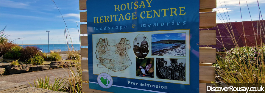
Rousay Heritage Centre
Delve into Rousay's past at the Heritage Centre. Here, you will find loads of text and photographs as you learn about Rousay's history.
Situated at the Ferry Terminal, and refurbished in 2021, it's perfect if you have some spare time before the ferry departs Rousay.
And if you are inspired to discover more about Rousay's many archaeological sites, visit our sister site,
www.AroundRousay.co.uk

